Hey, I'm Jaylin Basinger.
I am a lover of maps and specifically the creating of detailed cartographic maps to spatially represent topics I am intrigued by.
Check out my projects
My Background / About Me
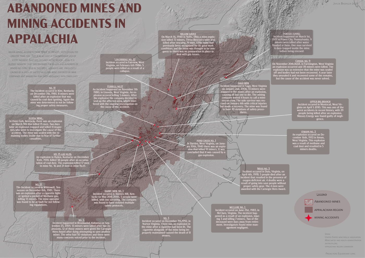
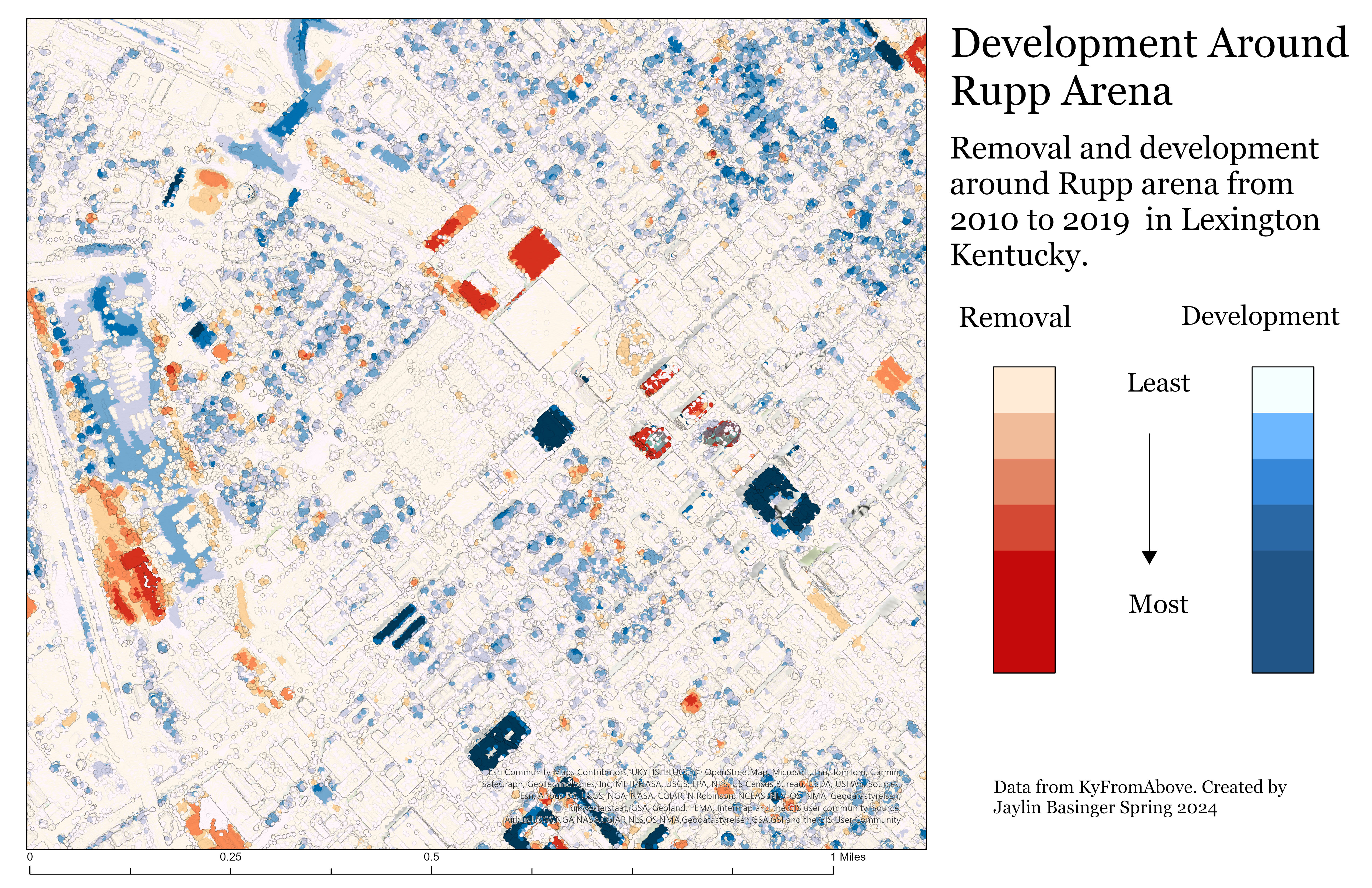
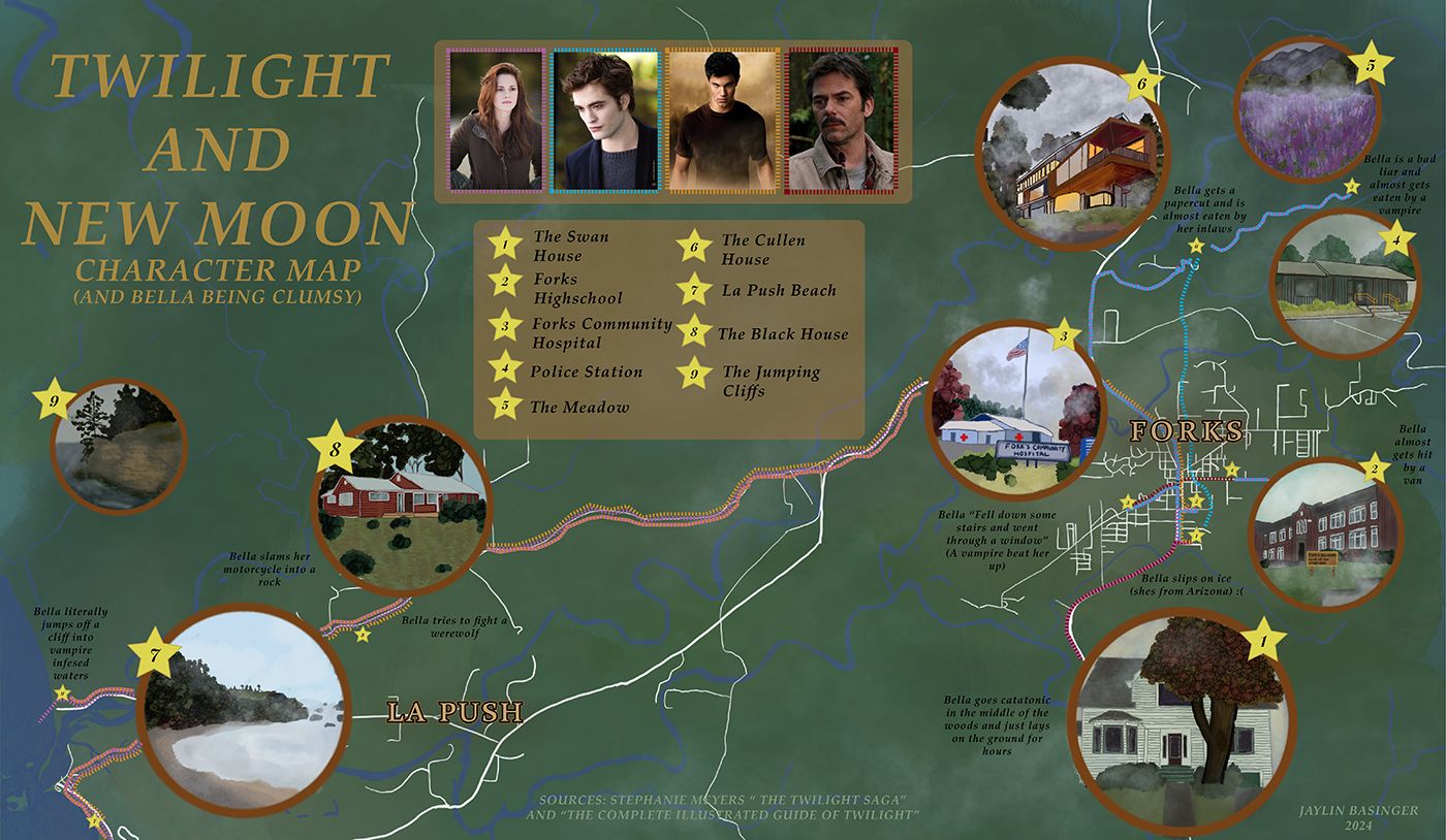
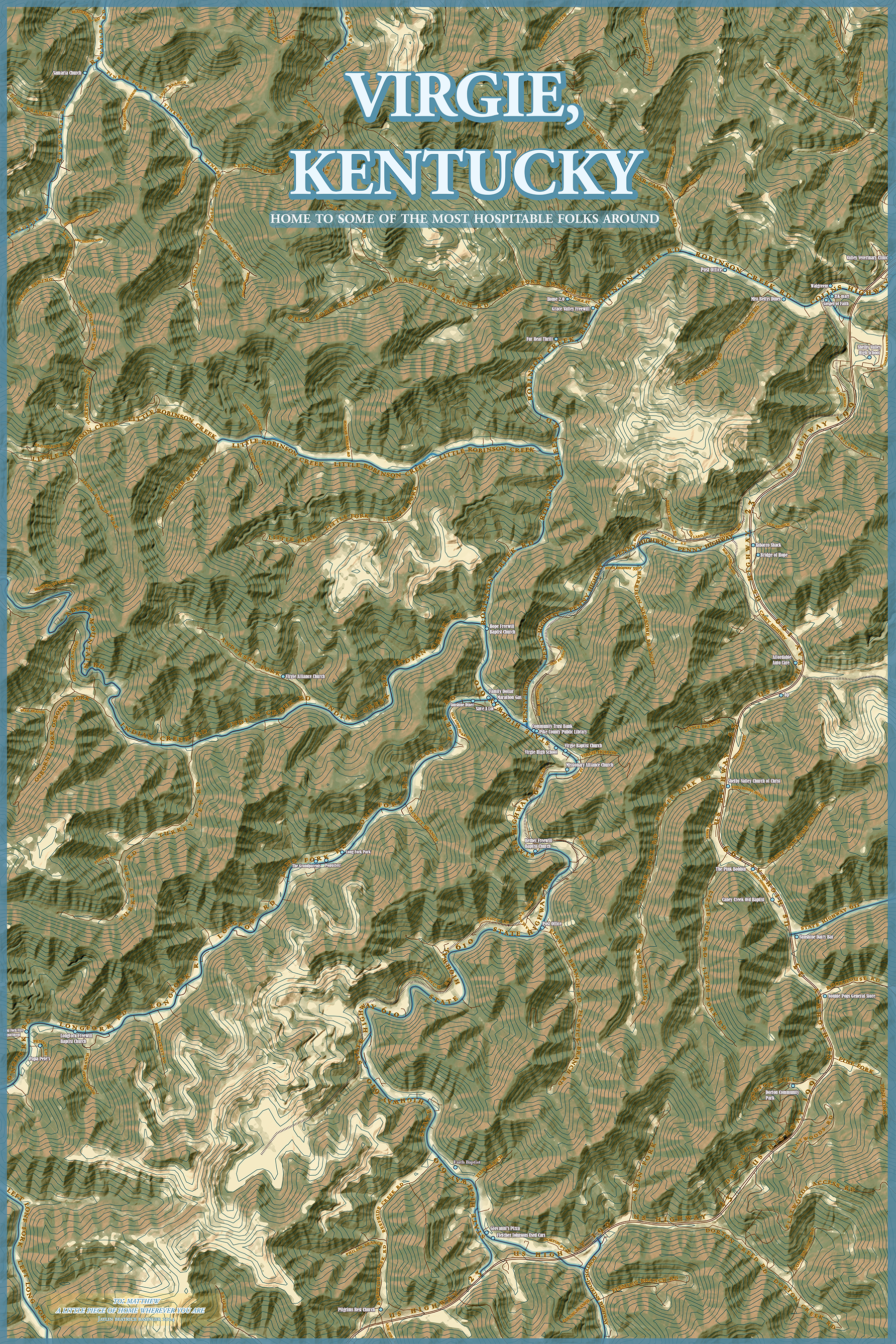
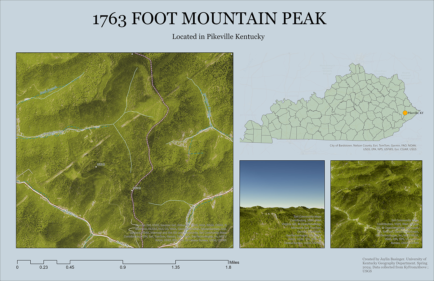
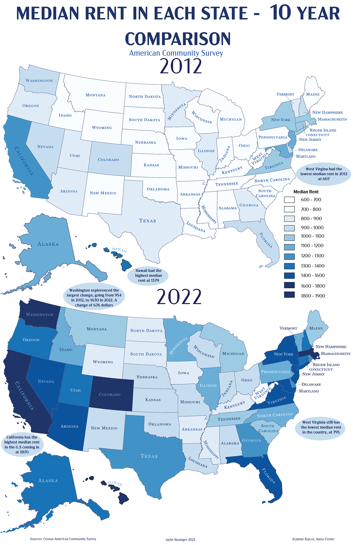
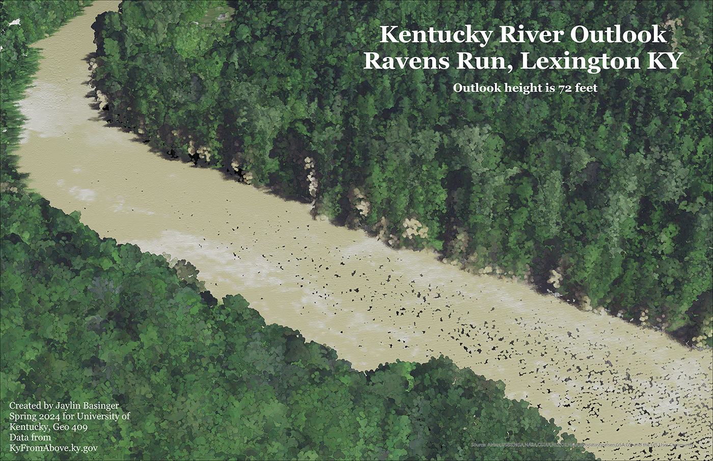
My name is Jaylin Basinger and I am a recent University of Kentucky Geography Graduate with a focus in cartography, GIS, and Urban Planning. I am in love with the art of map making and have published my favorite works below. I am proficient and frequently use softwares such as ArcGis Pro, Arc Online, and Arc Map and well as Qgis. I often use Arc softwares for GIS analyst duties while primarly using Qgis for my cartographic endeavors. With my creative map making process I use Adobe Photoshop, Illustrator, and Acrobat, as well as occasionally using the animation qualities of Blender to bring my DEM layers to life.
This site is a portfolio of my maps and the process of creating them, in hopes that I can track my progress in my GIS and cartography skills and continue to learn and create mapping works.
My Work / My Projects
The Last Frontiers Ghost Towns
This map is displays a handfull of the hundreds of abandonded towns in Alaska along with information regarding the history of the towns represented on the map.
Read More
Laurel Highlands Attractions
This map is of my hometown in the Laurel Highlands of Pennslyvania, and was created to expierment with DEM's and hillshade layers and turning them into 3D objects using animatation softwares.
Read More
Lexingtons Urban Service Boundary and the 2023 Proposed Expansion
This map was created to show the expansion of the Lexingtons Urban Service Boundary in 2023 in Lexington Ky. This map was my first time creating my own polygons through georefrencing in order to depict proposed expansion areas.
Read More
Appalachian National Forests
This map displays the Appalachian Region and its National Forests and was created to expierment with Tiff. files as welll as typography in cartography
Read More
Abandoned Mines and Mining Accidents in Appalachia
This map depicts the Appalachian region and marks each of its abandoned coal mines. The map also dives into mining accidents that happened and in the region and why. This map was to be all incompasing in the cartography skills I had learned at that point.
Read More
Development Around Rupp Arena
This map uses Lidar pointclouds to show how development has changed near Rupp Arena in Lexington Kentucky over a nearly 10 year period.
Read More
Twilight and New Moon Character Map
This is a semi-fictional charcter map of the movements of the main characters Twilight Franchise. The "map" was completley hand draw, with roads, towns, and rivers being refrenced from the real world and points being created based of events in the movies.
Read More
Virgie Kentucky
This map was the first map I made without a course assignment. Its a customized map for a friend of mine of thier hometown. I gathered the cordinates of special places, businesses, churches, etc. to represent the town and its character.
Read More
Pike County Mountain Peak
This is a rendered DEM of a mounain peak in Pikeville, Kentucky. This was created to expierment with viewing options and layouts in ArcGIS Pro.
Read More
10 Year Median Rent Comparison
This is a thematic map that shows rent changes over a ten year period in the U.S. using cleansed and Census Data to get the best depiction of change.
Read More
Kentucky River Outlook at Ravens Run
A colorized point cloud and first expierment with Lidar that shows the overlook of the Kentucky River at Ravens Run in the outskirts of Lexington.
Read More
Nu Metal Webmap
A first attempt at Web Mapping that displays research on all of the Nu-Metal bands of the late 90's early 00's and their orgins. Basemap created and hosted through Mapbox.
Read More