Lexington's Urban Service Boundary and the 2023 Proposed Expansion
This map was created to show the expansion of the Lexingtons Urban Service Boundary in 2023 in Lexington Ky. This map was my first time creating my own polygons through georefrencing in order to depict proposed expansion areas.
Project Details / Background
This map was created for my introduction to GIS class with the goal of documenting as issue in Lexington Kentucky. I chose to focus on the expansion of the Urban Service Boundary because I had been enrolled in an Urban Planning course at the time and we had focused on the Urban Service Boundary throughout the semester, as it was ongoing change happening at the Planning Commission. I had gone to a few of the planning commision meetings where the expnasion was discussed, and heard from community memebers and thier opinions on the expnasion. This map illistrated the controversy of the expansion and depicted how the boundary has expanded since its creation.
This project was the first in which I had to utalizing clipping and merging in order to clip the service layer to show each expansion and removal of land. I also created the proposed expansion area myself due to the city not wanting to share the data at the time. I did this by using the proposal area image material and parcel boundaries to geofrefence the expansion into a vector file. After I had gathered and created all my data, I was able to take the project from Qgis to adobe Illustrator to create the map layout. This map is one of my favorite works I have done, and its been used in my professors own work to work towards his PHD.
Image Gallery
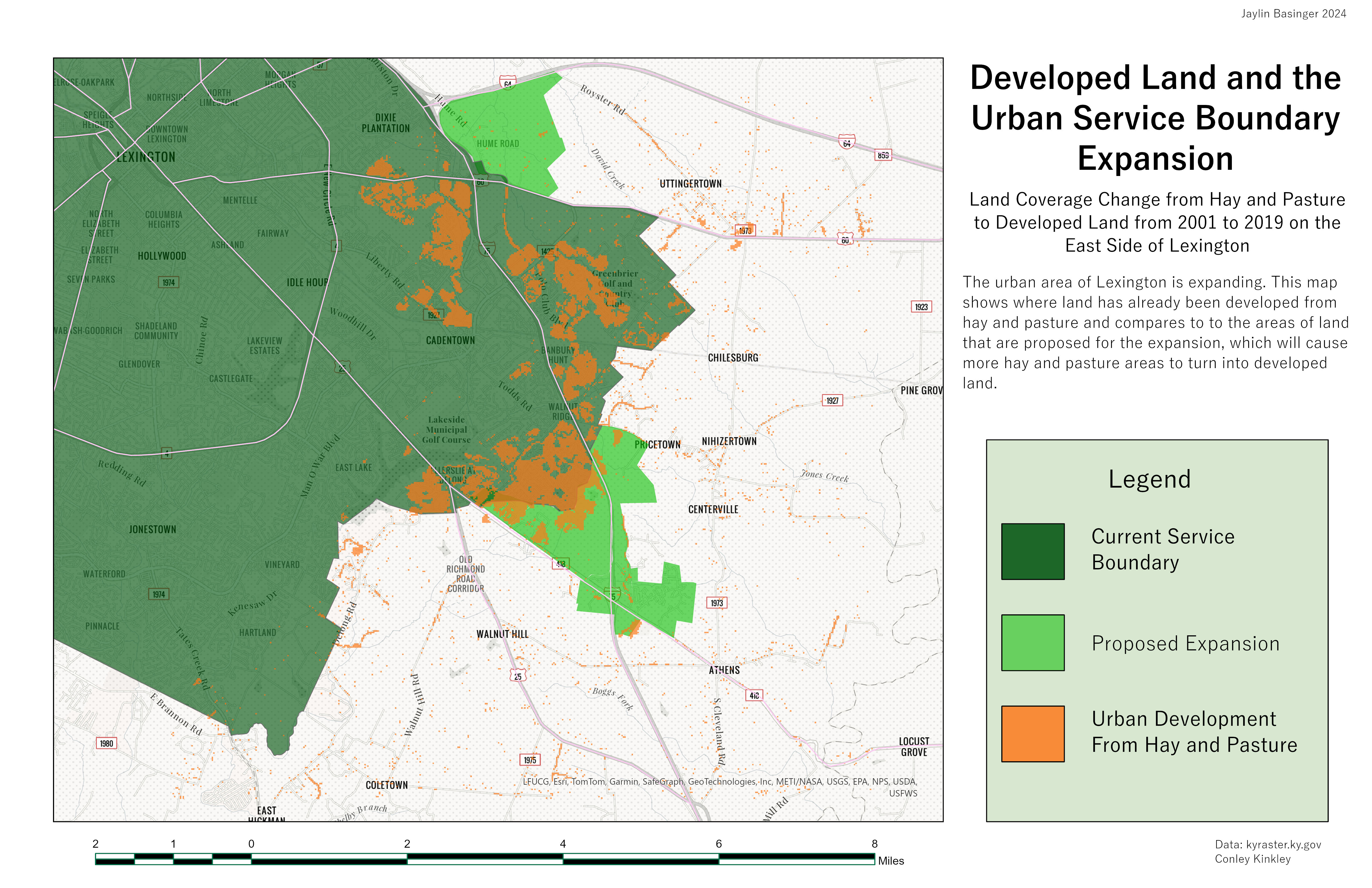 This map was created in a different GIS class but contributed to depicting the potential impact of the Urban Service Boundary Expansion.This map shows where hay and pasture lands would be impacted in the South-Eastern part of Lexington